
Urban Photonics · Sensing · Essay
The Sensor Has Eaten the City: Why Urban Photonics Needs a Better Story Than “Smart”
Every era picks a metaphor for how the mind works and, shortly afterward, picks the same metaphor for how a city works. Clockwork. Telegraph. Telephone switchboard. Computer. The latest one — city-as-dashboard, citizen-as-data-point — has had a decade to prove itself, and the verdict is more interesting than either the boosters or the critics expected. The sensors are still out there. The dashboards are still being built. The “smart city” pitch deck, though, has collapsed — and what replaced it is quieter, messier, and more consequential.
The Metaphor Problem
It is a well-worn observation that scientists describe the brain using whichever technology happens to be the most advanced of their moment. Ancient Greeks reached for hydraulic water clocks. Medieval thinkers reached for gears and clockwork. Nineteenth-century writers compared the brain to a telegraph network; twentieth-century writers upgraded the comparison to a telephone switchboard, and then, predictably, to a digital computer. Each metaphor captured something. Each also failed, eventually, in its own particular way.
Cities attract the same reflex. A city has been called a machine, an organism, an ecosystem, a circuit board, a network, a stream. For a brief and noisy period in the 2010s, the dominant metaphor was the computer — the city as a processing system, fed by data from sensors, governed by dashboards, optimised by algorithms. Sidewalk Labs was going to rebuild Toronto’s waterfront on that premise. Amazon was going to drop a city-scale headquarters into New York. Hudson Yards was supposed to bristle with so many sensors that its inhabitants would, in effect, be opting in to a continuous environmental survey simply by walking outside. Most of those flagship projects died, shrank, or quietly morphed into something more conventional. The dashboards are still there. The vision behind them mostly isn’t.
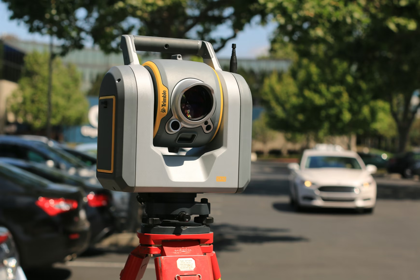
What did not die is the hardware. Every city in the developed world — and most in the developing one — is now saturated with optical sensing at a density that would have been unthinkable in 2005. Traffic cameras have evolved into computer-vision platforms. LiDAR rigs map urban canyons for autonomous-vehicle training data. Thermal imagers monitor rooftop HVAC loads. Multispectral satellites photograph every corner of the planet with a revisit cadence measured in hours. Ambient light sensors in a million smartphones report, in aggregate, the sky’s brightness curve over a neighbourhood. The city is being watched, constantly, by photons. What remains unsettled is who benefits from the watching, and whether the people doing the watching have any idea what they are looking at.
The Real Question
The interesting debate about urban sensing was never really about the sensors. It was about the reduction — the decision about which slices of messy urban life get converted into numbers, and which get ignored because they do not fit on a dashboard. Once a metric is chosen, it becomes a target. Once it is a target, it starts to distort the behaviour of whoever is being measured. That is not a technical problem. It is a governance problem wearing technical clothing.
What Urban Photonics Actually Is
Strip the marketing away and a modern city runs on five overlapping layers of optical sensing. None of them were deployed as part of a coherent plan. They arrived one vendor at a time, one pilot programme at a time, one procurement cycle at a time. The aggregate effect is a sensing stack that nobody designed and nobody fully understands.
| Layer | What It Senses | Who Owns It |
|---|---|---|
| Orbital | Daily to sub-hourly satellite imagery across visible, IR, and radar bands | Governments, commercial constellations, research institutions |
| Aerial | Drone and aircraft surveys, LiDAR topographic maps, photogrammetry | Municipal agencies, surveying firms, utilities |
| Infrastructure | Traffic cameras, red-light enforcement, transit platform CCTV, street lighting with embedded sensors | City government, transit authorities, police |
| Vehicle | Automotive LiDAR, dashcams, autonomous-vehicle sensor suites, fleet cameras | Private drivers, ride-share operators, logistics fleets |
| Personal | Smartphone cameras, AR glasses, wearable biometrics, doorbell cameras | Individuals and the platforms they feed |
Each layer feeds separate systems owned by separate parties with separate motivations. A driver’s dashcam captures the same intersection as the city’s traffic camera, the Tesla’s forward LiDAR, the Google Street View car that passed through last month, the doorbell camera on the corner house, and the commercial satellite that photographed the block this morning. Six optical records of a single moment, stored in six different databases, accessible under six different legal regimes. Nobody is responsible for reconciling any of it. Nobody is responsible for asking whether the aggregation of those six records into a coherent surveillance profile would be legal, useful, or ethical.
The Dashboard Problem
There is a long history of trying to run cities from control rooms. The most cinematic version was Project Cybersyn, commissioned by Salvador Allende’s Chile in the early 1970s. Its operations room was a tulip-shaped chamber with seven swivel chairs, each equipped with button-studded armrests, arrayed in front of wall-sized displays fed by telex machines from factories across the country. The idea was a kind of real-time national economic dashboard — data in, policy out. The real-time data never actually existed. Most of the wall displays, when they worked at all, showed hand-drawn slides pretending to be live telemetry. The coup came before the cables were finished being laid.
The aesthetic lives on. Contemporary municipal dashboards — the Rio de Janeiro Operations Centre, the New York City Situation Room, the endless CompStat rollouts in American police departments — owe more to Cybersyn’s theatrical staging than their architects would publicly admit. The dashboards are impressive. They are also, frequently, the problem. As critics have noted for a decade, a dashboard does not just display reality. It constructs the version of reality that officials then act on. What gets measured becomes what matters. What cannot be measured ceases to be discussed at budget meetings. That is how on-time transit performance became more important than whether the transit system actually carries enough passengers, and how “arrests made” became more important than “crimes deterred.”
The deeper issue — articulated particularly well by the media scholar Shannon Mattern, whose 2021 book A City Is Not a Computer remains the sharpest single critique of the smart-city paradigm — is that dashboards give their operators a false sense of omniscience. The filters determine what is visible. The metrics determine what is important. Everything else quietly slips beneath the visible water line of the data layer and is, functionally, invisible to the people making decisions. A thoughtful WIRED piece on Mattern’s work captured the core objection neatly: when everything is computational, we forget that the computation itself is a metaphor, and the metaphor is almost always wrong in the places it matters most.
Where the Hype Actually Broke
The peak of the smart-city pitch deck was somewhere around 2017–2019. Google’s sibling company Sidewalk Labs had secured the right to redevelop a twelve-acre chunk of Toronto’s waterfront with a vision that included wooden mid-rise construction, reconfigurable illuminated pavement, underground autonomous trash tubes, and a blanket of sensors dense enough to log pedestrian behaviour at the individual level. Amazon was mid-auction for its second-headquarters competition, which extracted eye-watering tax concessions from cities all over North America in exchange for the promise of a tech-infused urban campus. Hudson Yards, New York’s largest private real-estate development in decades, was being marketed in part on the sensor infrastructure its developers claimed it would deploy.
All three collapsed or shrank dramatically. Sidewalk Labs abandoned the Toronto project in 2020. Amazon’s New York headquarters fell apart after sustained community opposition. Hudson Yards got built, but the sensor density that had been promised quietly failed to materialise at anything close to the advertised scale. The specific reasons differed, but the common thread is worth noting: each project underestimated how much political legitimacy the “smart” vocabulary required, and overestimated how much consent residents were willing to give to private companies running infrastructure-grade surveillance in public space.
The Post-Smart-City Era
What came after is less dramatic but more pervasive. Private platforms now deploy the sensing infrastructure that flagship public projects could not. Ring doorbells capture more neighbourhood-level imagery than municipal cameras ever did. Ride-share company data logs more urban mobility patterns than any city transit department possesses. Dashcam footage from fleet operators is now a genuine input to insurance pricing, litigation, and quiet municipal decision-making. The “smart city” did not fail. It migrated — out of the branded flagship project and into a million ordinary pieces of consumer and commercial hardware, none of which anyone voted to install.
LiDAR as Accidental Urban Infrastructure
The single photonic technology that has most quietly reshaped the urban sensing layer is LiDAR. Originally a niche tool for topographic surveying and autonomous-vehicle research, it has become — through the same bottom-up accretion that defines most urban photonics — the best three-dimensional record of cities that has ever existed. The United States Geological Survey’s 3D Elevation Programme has produced nationwide LiDAR coverage of most of the continental United States at resolutions fine enough to map individual trees. European national mapping agencies have done similar work. Commercial fleets, driven by autonomous-vehicle development, have driven the equivalent data for every major city they operate in, often with decimetre-level accuracy refreshed many times per year.
What that means in practical terms is that almost any modern city is now knowable, from an altitude of a hundred metres, at a fidelity that would have required a helicopter and a survey team twenty years ago. Flood-plain modelling uses it. Solar-rooftop studies use it. Urban heat-island research uses it. Emergency planning uses it. And autonomous-vehicle companies use it as the base layer on top of which their perception systems are trained. The data is not always public. Often the best copies of a city’s three-dimensional structure live inside private corporate databases that municipal governments would struggle to even access, let alone govern.
| Urban LiDAR Application | What It Enables |
|---|---|
| Flood-plain modelling | Sub-metre accurate runoff simulations for storm preparedness |
| Solar potential analysis | Roof-by-roof assessment of irradiance for installation planning |
| Urban forestry | Canopy height, health, and coverage measurement at city scale |
| Building-energy modelling | Massing and shading inputs for climate retrofit programmes |
| Autonomous vehicle HD maps | Centimetre-accurate base layer for perception-system training |
| Historical preservation | Non-destructive scanning of heritage structures for restoration |
| Post-disaster assessment | Before/after comparison for earthquakes, fires, and floods |
The Public-Health Dimension Almost Nobody Talks About
The history of urban design has always been, in significant part, a history of public-health response. Quarantine protocols emerged from Renaissance trade. The cordon sanitaire was a public-health tool before it was anything else. John Snow’s famous cholera map of 1850s London was, effectively, an early exercise in spatial epidemiology. Baron Haussmann’s rebuilding of Paris under Napoleon III was as much about fighting cholera and tuberculosis as it was about imperial aesthetics. The hygiene and sanitation movements of the early twentieth century produced, among other things, modernist architecture — the clean lines, sunlit interiors, cross-ventilation, and easily washed surfaces that we now read as stylistic choices were originally engineered as disease control.
COVID-19 made the urban-photonics stack suddenly relevant to a conversation that had been running for centuries. Thermal imagers deployed at airport terminals and public buildings were a photonic intervention into epidemic response. Crowd-density sensors in transit stations were a photonic intervention into social-distancing policy. Indoor CO₂ monitors — not strictly photonic, but operating on similar absorption-spectroscopy principles — became, briefly, household objects as schools and offices tried to quantify their ventilation. The optical sensing layer, built for one set of purposes, turned out to be the infrastructure through which urban public-health response got delivered. That is not going away. The next respiratory pandemic, whenever it arrives, will be monitored and managed through the sensors we installed for entirely different reasons.
The Quiet Counter-Argument: Light as Pollution
Any serious discussion of urban photonics has to acknowledge the photons going the other way. Light pollution is the urban photonic story that does not get covered in industry conferences. Skyglow above major cities now makes the Milky Way invisible to more than a third of the human population. Artificial light at night disrupts circadian rhythms, bird migration, insect populations, and, through a chain of ecological effects, the broader food web. LED streetlight conversions — pitched initially as an energy-efficiency win — in many cases made the problem worse by shifting emissions toward blue wavelengths that scatter more aggressively in the atmosphere and suppress melatonin more strongly in nearby residents.
The photonics industry knows how to solve this. Warm-white LEDs with careful spectral tuning, full-cutoff fixtures that direct light only where needed, dimming schedules tied to pedestrian activity — these are all available technologies. What has been missing is the regulatory and political demand. That may be shifting. A handful of European cities have begun implementing serious dark-sky ordinances. Some US states have followed. International Dark-Sky Association accreditations have expanded meaningfully. The irony is hard to miss: at the same moment cities are deploying ever more elaborate light-based sensing, they are starting to recognise that the emitted light itself is a problem worth managing.
The Governance Gap
The hardest problem in urban photonics is not technical. The sensors work. The data pipelines work. The analytics work. What does not work, almost anywhere, is the governance structure for deciding what the sensors should be pointed at, who gets to access the data, how long it gets retained, and what happens when the optical record of a public space is subpoenaed in a criminal case or purchased by an insurance company. Legal frameworks designed for an era of film cameras and phone taps do not translate cleanly to an era of always-on multispectral imaging. The European Union has made the most serious attempt at a coherent answer through GDPR and its emerging AI Act, but even those frameworks leave enormous ambiguity about the aggregation of individually innocuous optical records into compositely invasive profiles.
Municipal governments are not, as a rule, well-equipped for the job. The technical expertise required to evaluate a vendor’s ToF module, understand the implications of a LiDAR-based pedestrian-tracking system, or interrogate the training data behind a traffic-camera machine-learning model is scarce in city-hall procurement departments. Cities tend to buy the systems first and figure out how to oversee them later, if at all. That pattern produces the sensor density we now observe without the governance layer that should accompany it. A more mature field of urban photonics would invert that sequence: governance frameworks first, then procurement, then deployment. We are nowhere near that.
| Governance Question | Current State |
|---|---|
| Who owns sensor data collected in public space? | Usually the vendor, sometimes the city, rarely the public |
| How long is imagery retained? | Highly variable; often governed by contract, not statute |
| Under what legal process can law enforcement access it? | Varies by jurisdiction; often looser than for older surveillance tools |
| What consent applies to passers-by? | Typically none beyond posted signage |
| Can aggregated records be sold to third parties? | Often yes, under data-broker arrangements |
| Who audits the accuracy of automated analysis? | Rarely anyone in a structured way |
The Library as Alternative Metaphor
One of the more durable alternative visions of urban intelligence does not involve dashboards at all. It involves libraries. The modern public library, as it has evolved over the past thirty years, is no longer primarily a place to borrow books. It is a node in the urban information network — a place with internet access, meeting rooms, career counselling, children’s programming, refuge during heatwaves, a stack of newspapers in a dozen languages, and, increasingly, seed banks and tool libraries and fabrication facilities. It is, functionally, what the “smart city” was supposed to be: a place where information flows freely between residents, their environment, and the collective institutions that serve them.
It is also the antithesis of the dashboard model. A library does not surveil its users. It does not track their borrowing history to sell to advertisers. It does not optimise them for throughput. It serves them, and the serving is slow, uneven, and resistant to metrics. Which is exactly why libraries do not feature prominently in most smart-city pitch decks. They do not generate the kind of data that dashboards want. They resist the reduction. In doing so, they preserve a model of urban intelligence that is not purely computational — and one that, increasingly, looks like the right template for what comes after the dashboard era winds down.
What Comes Next
Urban photonics is moving into a quieter, more embedded phase. The flagship projects are mostly done. The rhetoric has cooled. What remains is the actual work of building the sensor-rich city responsibly — upgrading streetlights to spectrally tuned LEDs that do not poison the night sky, integrating LiDAR base maps into public flood and fire planning, writing procurement contracts that reserve ownership of sensor data for the public, and resisting the siren song of the dashboard when the dashboard is not measuring the thing that actually matters.
The photonic city is not an idea anymore. It is a condition. The question that follows is whether it becomes a condition citizens have some say in, or whether it continues to accumulate as a by-product of a thousand private procurement decisions made by parties without obvious accountability. The sensors will keep getting cheaper. The models analysing their output will keep getting better. The political conversation about what all of that should be used for has barely begun. A city is not a computer. It is also not, any more, a place that can be understood without thinking seriously about the photons bouncing off its surfaces and into its databases, every second of every day. The upgrade the dashboard metaphor was supposed to deliver has already happened. What we do with it next is the only question left worth arguing about.
Frequently Asked Questions: Urban Photonics and Smart Cities
1. What is urban photonics?
Urban photonics is the layer of optical sensing, illumination, and light-based communication infrastructure that now runs through almost every modern city. It includes streetlights, traffic cameras, LiDAR surveys, satellite imagery, doorbell cameras, automotive sensors, and the vast array of consumer devices that process light for a living.
2. What happened to the “smart city” movement?
The flagship smart-city projects of the late 2010s — Sidewalk Labs in Toronto, Amazon HQ2 in New York, the sensor-saturated vision of Hudson Yards — largely collapsed, shrank, or quietly failed to deliver on their original promises. The underlying sensing infrastructure, however, kept expanding through private deployments and incremental public procurements.
3. Is the “smart city” dead?
The branded version is essentially dead. The phenomenon is not. Cities are more sensor-saturated than they have ever been, but the sensing stack has arrived through thousands of independent vendor decisions rather than any coherent municipal strategy.
4. Why did Sidewalk Labs leave Toronto?
Sidewalk Labs formally abandoned its Toronto waterfront project in 2020 after sustained public concern about data governance, surveillance, and the legitimacy of a private technology company designing public infrastructure. Official statements cited economic uncertainty, but the political pressure had been building for years.
5. What is Project Cybersyn?
Project Cybersyn was a distributed decision-support system commissioned by the Allende government in Chile in the early 1970s. Its operations room was meant to serve as a real-time national economic dashboard. It is often cited as an ancestor of modern municipal control-room projects.
6. How does LiDAR fit into urban sensing?
LiDAR has become the primary source of three-dimensional urban data. National mapping agencies, autonomous-vehicle companies, and municipal survey programmes have collectively produced detailed LiDAR coverage of most major cities. It underpins flood modelling, solar studies, infrastructure inspection, and autonomous-vehicle mapping.
7. Who owns urban sensor data?
It depends. Data collected by municipal infrastructure is often owned by the city, subject to contractual rights granted to vendors. Data collected by private devices — doorbell cameras, dashcams, smartphones, commercial vehicles — is typically owned by the platform, not the device owner or the passer-by captured in the imagery.
8. What is light pollution, and why is it a photonics issue?
Light pollution refers to excessive or misdirected artificial light at night. It disrupts ecosystems, harms human health, and obscures the night sky. It is a photonics issue because the solutions are photonic — spectral tuning, full-cutoff fixtures, and intelligent dimming all sit within the discipline of lighting design.
9. Have LED streetlights made light pollution better or worse?
Both, depending on how the conversion was done. Early LED streetlight rollouts often used cooler colour temperatures that scatter more in the atmosphere and suppress melatonin more strongly. Better-designed LED conversions, using warmer colour temperatures and directional fixtures, can significantly reduce skyglow while also saving energy.
10. What is a dark-sky ordinance?
A dark-sky ordinance is a municipal regulation that restricts outdoor lighting to reduce light pollution. Requirements typically include shielding, maximum brightness, approved colour temperatures, and curfew-based dimming. A growing number of cities worldwide have adopted some version of such rules.
11. Do traffic cameras use machine learning?
Most modern traffic cameras do far more than capture video. They use computer-vision models to count vehicles, classify their type, read licence plates, detect congestion, identify violations, and sometimes flag suspicious activity. The accuracy of those models varies and is rarely externally audited.
12. What is the difference between a sensor and a camera in this context?
In practical urban-photonics usage, the distinction has blurred. A modern “camera” is a sensor feeding computer-vision software. A modern “sensor” is often a camera paired with a classification model. The important question is what the system does with the image, not whether humans are in the loop.
13. Are doorbell cameras part of urban photonics?
Functionally, yes. Networks of private doorbell cameras — some of them integrated into police-access programmes — now produce more neighbourhood-level visual data than most municipal camera systems. Their aggregate effect on urban surveillance is significant even though each individual device is privately owned.
14. How did COVID-19 change urban photonics?
It accelerated the deployment of thermal imagers at public venues, crowd-density monitoring in transit systems, and indoor air-quality sensing in schools and offices. Some of those deployments receded after the acute phase of the pandemic. Many did not, and they now form part of the permanent sensing stack.
15. What role do libraries play in a sensor-rich city?
Libraries function as public spaces where information flows in both directions without the surveillance logic of commercial platforms. They are often cited by critics of the smart-city paradigm as a more durable model of urban intelligence — one that does not require monetising the people it serves.
16. Does urban LiDAR data penetrate buildings?
No. LiDAR measures surfaces the laser beam can reach. It cannot see through walls or roofs. It can, however, map exterior structure with centimetre-level accuracy, which is more than enough to support detailed three-dimensional reconstructions of the urban envelope.
17. What is a digital twin of a city?
A digital twin is a three-dimensional, data-rich simulation of a real physical environment. Many cities have commissioned digital-twin projects that combine LiDAR, photogrammetry, and sensor feeds into a continually updated model. The ambition is to simulate policy interventions before implementing them in the physical city.
18. How accurate is commercial satellite imagery of cities?
Leading commercial satellite constellations now offer sub-metre spatial resolution with refresh cadences that can exceed one image per day over major urban areas. Higher-resolution aerial photography goes further still. The gap between civilian and classified imaging capability is narrower than it was a decade ago.
19. Is facial recognition being used in cities?
Widely, though unevenly. Some jurisdictions have banned or restricted municipal use of facial recognition. Others permit it broadly. Private deployments — in retail, transportation hubs, and residential buildings — are even more variable. The regulatory environment is still being negotiated in most places.
20. What is spectral tuning in streetlighting?
Spectral tuning is the deliberate shaping of a lighting fixture’s output wavelengths to optimise for specific goals — reducing blue-light scatter, preserving nocturnal ecosystems, improving colour rendering for pedestrians, or minimising effects on nearby astronomy observatories. Good dark-sky lighting design depends heavily on it.
21. How is urban photonics regulated at the EU level?
The primary instruments are GDPR, which governs personal data broadly, and the emerging AI Act, which regulates higher-risk automated decision systems. Neither framework was written specifically for urban sensing, and substantial grey areas remain around aggregated optical data collected in public spaces.
22. Can urban sensing improve public health?
Yes, meaningfully. Pollution sensors, thermal imagers for heat-vulnerability mapping, ventilation monitoring in public buildings, and epidemiological mapping all benefit from denser urban sensing. The question is whether the same sensing capacity also generates surveillance harms that outweigh the public-health benefits.
23. What does “the dashboard is the message” mean?
It is a shorthand critique: once a city builds a dashboard, the dashboard starts to dictate what counts as reality. Metrics that fit on the screen become priorities. Metrics that do not become invisible. The act of measuring changes the thing being measured, sometimes dramatically.
24. Who is Shannon Mattern?
Shannon Mattern is a scholar of media, architecture, and urbanism whose 2021 book A City Is Not a Computer remains one of the most influential critiques of the smart-city paradigm. Her work argues against the reduction of urban complexity to data streams and dashboards, and in favour of richer, more plural models of urban intelligence.
25. What should cities do differently going forward?
Three things. Write data-governance frameworks before procuring the sensors they govern, not after. Treat light itself — not just imaging — as a pollutant that deserves careful spectral and directional design. And preserve non-computational urban institutions like libraries, parks, and public plazas as counterweights to the optimisation logic of the dashboard city.